Use Cases


Overview
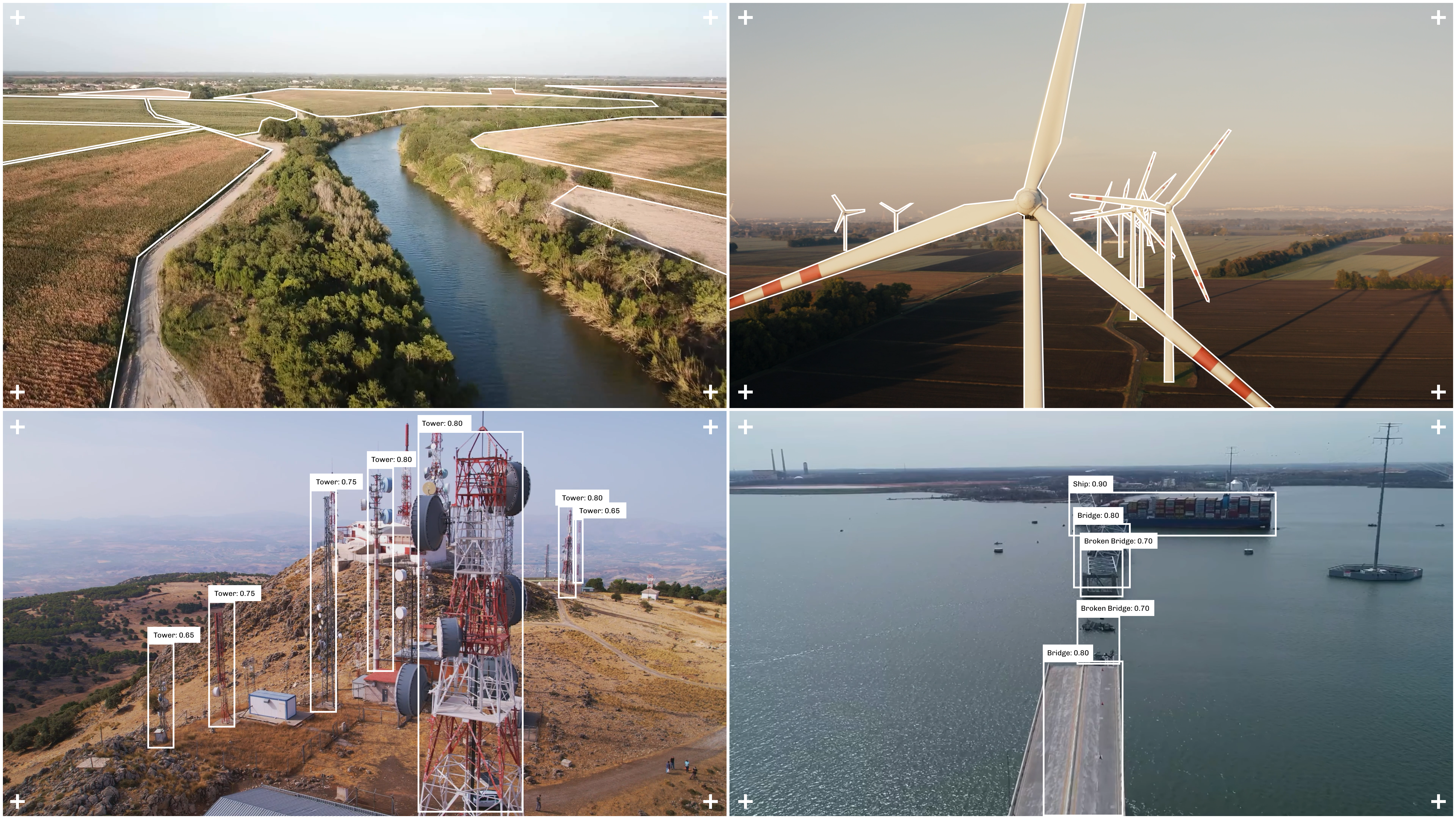
Actionable insights, anywhere
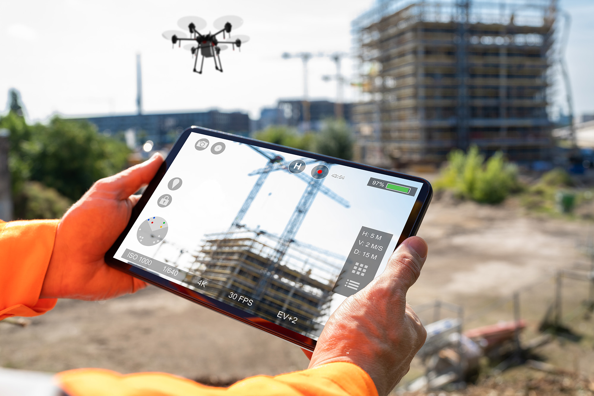
Integrating LEIP with ArcGIS enables real-time decision-making by processing data where you collect it. Run AI analysis directly on your drones, sensors, cameras, and other edge devices, even offline.


Feature
Make smarter choices right when you need them
- Eliminate delays: Achieve real-time decision-making anywhere with edge AI, even in remote locations with limited bandwidth.
- Process data efficiently: Edge AI reduces overall computing needs, minimizing device power consumption.
- Reduce infrastructure costs: Analyze data locally, minimizing reliance on expensive internet connections and cloud infrastructure.
Feature
Get faster, ultra-efficient AI from our all-in-one platform + ArcGIS
- Streamlined Development: Train AI models with LEIP alongside ArcGIS for real-time, on-device geospatial analysis.
- Simplified workflow: LEIP streamlines the AI workflow, eliminating the need for extensive machine learning expertise within your team.
- Adapt to changing needs: LEIP’s field-updatable AI empowers you to analyze results, make adjustments through a simple interface, retrain, and redeploy the AI model directly on your device.

Feature
Take GIS to the edge with LEIP
Your most valuable data lives at the edge. Shouldn’t your AI be there too? Watch how LEIP + ArcGIS enables faster, data-driven decisions powered by location intelligence.

testimonials
What our partners say.
“LEIP streamlines workflows and empowers our users by enabling them to train and deploy models directly within ArcGIS. This allows for faster decision-making, particularly valuable in remote locations with limited bandwidth.”
Beau Legeer, Esri Director of Imagery and Remote Sensing.
Featured Resources
Learn more about our partner solutions
video
LEIP and ArcGIS: Powering real-time analysis on the edge

video
LEIP + ArcGIS enables faster, data-driven decisions powered by location intelligence
Ready to get started?
Schedule a meeting with an AI expert today.