See how LEIP enables you to design, optimize and deploy AI to a variety of edge devices–at scale. Schedule a Demo
See how LEIP enables you to design, optimize and deploy AI to a variety of edge devices–at scale. Schedule a Demo
In recent years, a rise in weather and geological catastrophes has prompted researchers and disaster management experts to look to AI for assistance in predicting, mitigating, and responding to natural disasters. AI-enabled drones and sensors support the Federal Emergency Management Agency (FEMA) phases of emergency management: preparedness, response, recovery, and mitigation. Coupling edge AI with geospatial data has the potential to be a game changer. The integration of the Latent AI Efficient Inference Platform (LEIP) with Esri’s ArcGIS system unlocks new levels of prediction and detection for disaster management experts.
Latent AI has been leading the charge in helping the government realize the operational benefits of applying edge AI to unique use cases where the ability to adapt in the field is necessary. This experience can be extremely valuable during every stage of disaster management.
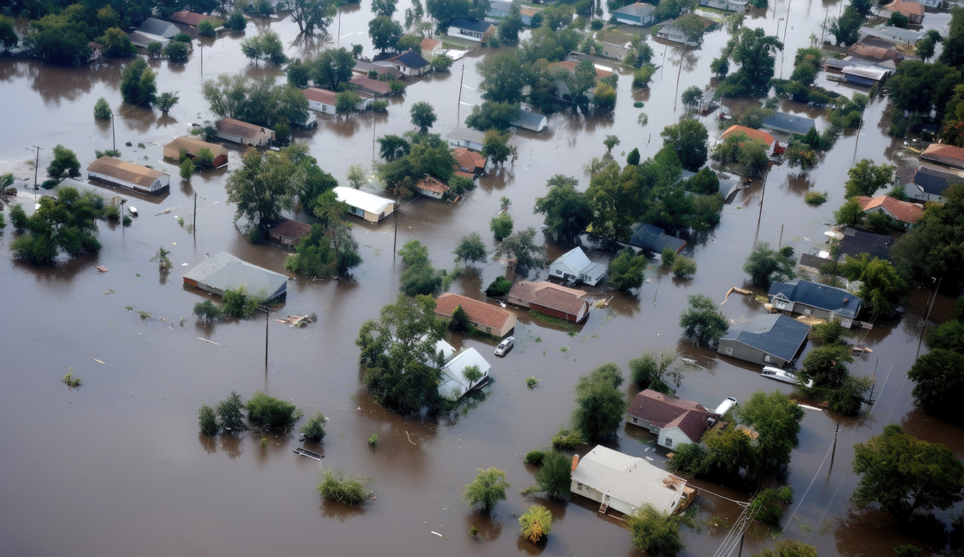
Disaster preparedness hinges on understanding the landscape. Geospatial data acts like a digital map, capturing details about natural and man-made features. It can track how these features change by noting vegetation growth and water levels. For example, by analyzing rain data over several years, disaster management experts can identify low-lying areas prone to flooding and proactively protect communities. For instance, LEIP’s edge AI models can be trained with historical traffic patterns to identify optimal evacuation routes and help disaster management experts pre-position first responders, medical supplies, and other resources for faster, more efficient emergency response.
When disaster strikes, this groundwork becomes even more crucial. The ability to analyze real-time data is essential for effective response and is where LEIP and ArcGIS come into play.
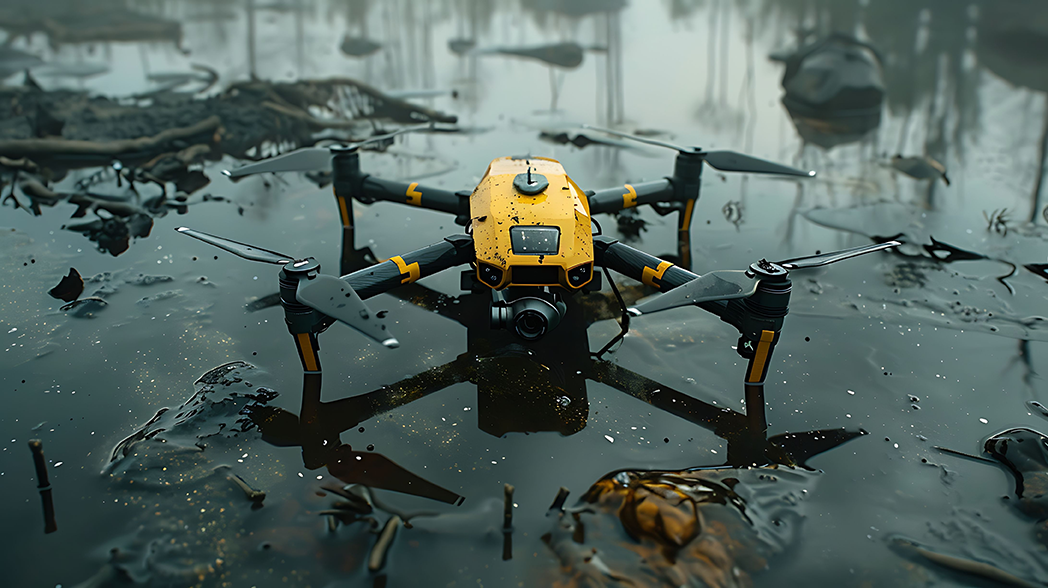
Fast and accurate assessment is crucial during the response stage. LEIP’s edge AI models deliver real-time insights that empower first responders to make critical decisions. Our advanced anomaly detection algorithms don’t require training on every single object. Instead, they learn to identify anything that deviates from the norm. In areas with limited communication infrastructure, first responders can deploy the initial models in drones to survey the region, determine damaged structures, identify roadway debris, and locate downed power lines. This critical data can be seamlessly integrated with ArcGIS, Esri’s geospatial information system, to enable real-time collaboration and updates to the disaster zone map, ensuring all responders have access to the latest information.
The strength of the LEIP platform is that it answers disaster management experts’ inherent need for flexibility to adapt and fine-tune models based on the changing conditions of natural disaster events. The platform provides workflows for the various stages of the model’s life cycle, such as testing, integration, deployment, infrastructure, and release management. It provides a trusted pipeline for developers to reuse with different models and/or hardware on the same dataset.
The LEIP and ArcGIS integration also offers a unique capability to review collected inferences and to adjust or tune the data in the field. Together, these tools facilitate real-time decision-making in remote locations with low bandwidth. Using Latent AI’s field-updatable toolkit, users can analyze results, make adjustments through a simple interface, and retrain and redeploy the AI model directly on their drones, sensors, or other edge devices.
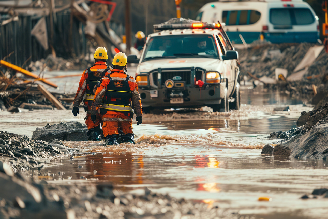
During the recovery period, restoration efforts occur concurrently with regular operations and activities, and some of the previous uses of edge AI are applied throughout recovery. For example, edge AI in drones can continue generating new mappings to rebuild damage. Edge AI can also be used to inspect buildings before, during, and after reconstruction or removal. As an area is cleared of debris and structures are rebuilt, experts in the field can assess and quantify recovery efforts, update associated monitoring models, and feed updates into ArcGIS for broader distribution and decision-making.
As disaster management and associated fields like search and rescue continue to advance into emerging technologies, new use cases arise that LEIP and ArcGIS provide. LEIP is the ideal fit for defense applications because it allows developers to:
Discover more use cases for edge AI here. Explore how LEIP and ArcGIS work for your unique edge AI application and schedule a demo today.

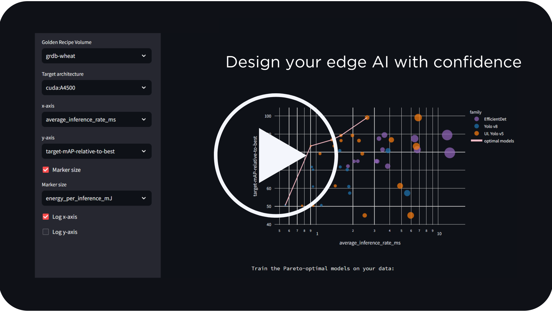
Watch how LEIP helps you start training computer vision models in minutes instead of months